
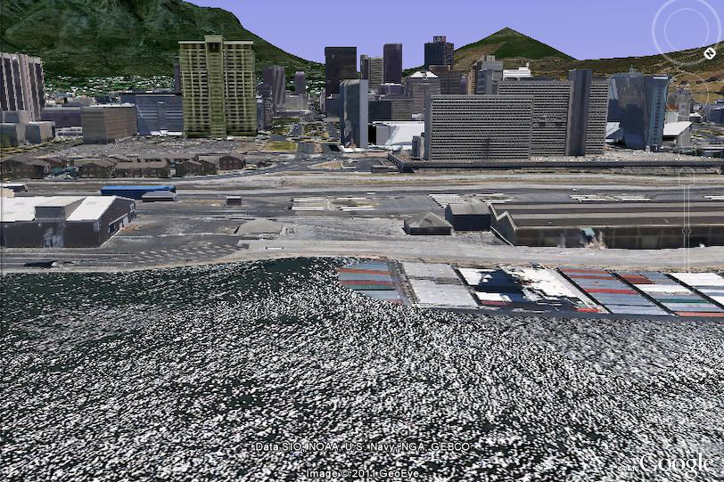
Isn't it crazy how much Cape Town has changed over the years? This view of Cape Town (from the harbour) shows Table Mountain on the left and Lion's Head on the right. The road that you see stretching across the water, into the city, is Adderley Street - our cities main road.
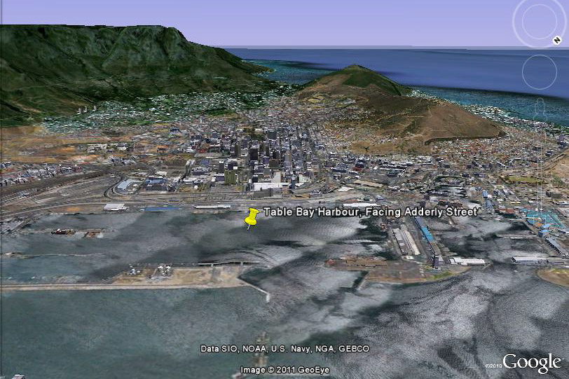
Take a look at these two photos that I grabbed from Google Earth - they show a modern version of the same view as the main photo. You'll notice that although Adderley Street still leads to the harbour area, it no longer allows direct access to the harbour, and the bridge that use to extend over the water has long since disappeared.
Marc
Nice photo! In fact, if the pier were still there today it would actually be “in” Adderley street because most of the foreshore is recalimed land. In the good old days the sea went right up to the Castle, meaning the pier would be on land today and not in the harbour.
Paul
Post authorMark, I still find it weird to think how much of the land we’ve reclaimed over the years. What’s odd that I’ve found shells even up against Tygerberg Hill – perhaps there was more reclamation that we think!
Bev Gregory
I have two old photographs taken by Ray Ryan in 1935 of the old Pier – he has written on the bottom : “built in 1910 and demolished in 1939”. I was given to understand that the current fountain is where you can see the old “bandstand” section in your photo but I think that’s incorrect and is further back where the first “round” bit can be seen. I think the reclaimed land was up to the end of the old Pier. Can you enlighten me on this?
Paul
Post authorUnfortunately I don’t know too much about the reclamation Bev. It would be interesting to see the photos you have – perhaps you could scan them and post them online somewhere?
Marc
I have a very old ordinance survey map / chart (about double A0 size) of the city that covers this area. It’s not dated, but the pier is on the map, I remember that. It’s been in the family for as long as I can remember. I’ll try find it and send in some photos. It might help.
Bev
My pics are very similar to the one above, except that Ray took them from the Pier Tower – they are large framed photos but I will take a photograph of them and post it. Ray’s (who has passed away) daughter managed to keep some of his photos – one of which is a depressing photo showing the Pier Tower broken in half during the demolishing of the whole structure. Sadly, when Ray Ryan retired he sold his photographic business and the new owners literally dumped suitcases full of photographs taken in and around CT from the early 1930’s.
I will post my pics next week as I am going away for a couple of days.
Paul
Post authorThanks Marc, that’ll be awesome. I have a friend who works for the government surveying department – perhaps I should find out what imagery they have.
And Bev, that’s terrible! Dumping all those photos was a tragedy. Something that I’ve been wondering about for my own website is how to go about archiving it. When Kerry-Anne and I are no longer around to pay the hosting costs the provider will simply deactivate and delete the site. It would be a shame, I think. Yes please, post the photos if you get a gap.
susie joubert
Please could you tell me how to get in touch with Bev? Or get her to contact me directly? I would love to get hold of Ray Ryan’s daughter to ask permission (and pay her a fee!) for using an old 1935 photo of her father’s in a book I am writing about Cape Town. I’ve been trying to track him down and this is the first time I’ve come across someone who has a lead…
Thanks a million’
Suzie
Paul
Post authorI’ve just sent Bev your email address Suzie – in case she’d like to take it further.